More Geology
“The desert tells a different story every time one ventures on it.” — Robert Edison Fulton Jr.
Deserts of the western U.S. are deserts because of the rain shadow created by the Peninsular, Transverse, Sierra Nevada, and Cascade Mountain ranges. These majestic ranges create a hurdle to storms originating in or near the Bering Sea and sweeping south and east across the continent. Warmer air has a much greater capacity to hold onto moisture suspended as water vapor. As the storms are pushed into the colder air at the high elevations of this collective wall of mountains, the storms are no longer able hold on to the water they carry, and so these massifs effectively wring the moisture from the storm clouds, drenching their windward slopes, but leaving little or none for the leeward slopes and basins. Hence, a desert is created.
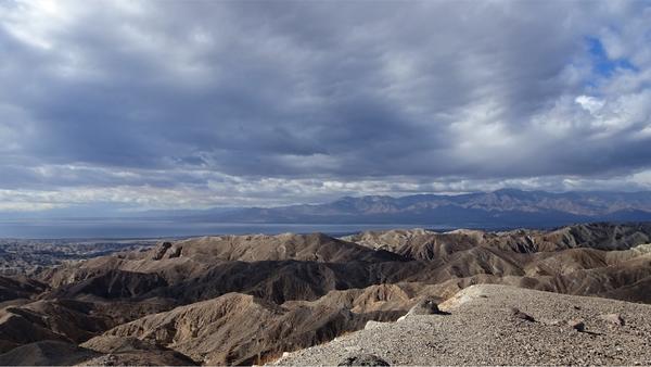
The origin of these mountains is well understood; subduction of the Farallon Plate below the North American Plate released energy in the form of magma plutons that rose through the earth’s crust forming a chain of volcanos from what is now British Columbia into Baja California. Where the Farallon Plate was fully subducted, from northern California south, plutons ceased to rise. The volcanos ceased their activity and eroded away, leaving the igneous crystallized magma cores below them, called batholiths, as the mountains we see today. That explains the origin of those rain shadowing mountain ranges, but east of that wall of granite there are mountains scattered throughout the deserts. This region is collectively referred to by geologists as the Basin and Range, so called for the flat arid basins alternating between narrow mountain ranges, but how those mountains formed is less clear.
During the Paleozoic, the Cambrian through the Permian Periods, some 550-250 million years ago, western North America was covered by a shallow sea, and trilobites reigned as one of the most abundant life forms. During that roughly 300-million-year period the spent bodies of diatoms, trilobites, corals, and a myriad of other organisms, rained down to cover the floor of the shallow sea. Over millions of years sea-floor sediments compacted to form mudstones, siltstones, and limestone — sedimentary rocks comprised of the calcium and carbon-rich shells and exoskeletons. Some of those rock layers experienced more pressure and heat, as magma plutons rose through them, creating metamorphic layers of dolomite, and if the heat and pressure was especially intense, marble. Limestone, dolomite, and marble outcrops are scattered across the lower elevations of the desert facing slopes of the San Bernardino, Santa Rosa, and San Jacinto Mountains, and are testimony of that ancient sea and the effect of the heat and pressure sediments were subjected to as these mountains were formed. That heat and pressure rendered the fossil elements of sea floor sediments unrecognizable, but the carbonaceous signature of past spent organisms is clear evidence of their contributions in creating these rocks.
As the volcanos, and then underlying batholiths rose and uplifted, so did the entire western North American Plate with its layers of mudstones, siltstones, and limestone. The sea retreated to the west, forming what we now know as the Pacific Ocean. That portion of the earth’s crust east of the Peninsular, Transverse, Sierra Nevada, and Cascade Mountain ranges stretched as it rose. Some blocks of the crust continued to rise while others collapsed. The collapsed sections are the basins, the remaining blocks are the mountain ranges of what we now call the Basin and Range.
In some cases, this fracturing allowed magma to rise into new lava flows, like in the Cima Dome region of the Mojave Desert, far more recent than the volcanos that previously topped the Sierra Nevada, Transverse and Peninsular Ranges. Because some of the mountain ranges did not undergo as much heating and pressure as did the rain shadowing walls of granite, they are not all comprised of igneous rocks, and the seafloor bedding is still evident. In some, like the Providence and Cadiz Mountains, one can find mudstone outcrops with clear trilobite fossils. There are also limestone caverns with stalactites and stalagmites in the Providence Mountains and in Great Basin National Park.
Fossils, and in some cases the lack of fossils, help us interpret the geological history of landscapes. While the macro-Paleocene fossils (fossils visible without the aid of powerful microscopes) of the Peninsular and Transverse Ranges were rendered into dolomite and marble outcrops, there are more recent fossil deposits. The badlands of Anza Borrego Desert State Park are rich in Pleistocene fossils two million to 20,000 years in age. Prehistoric mammoths and mastodons, giant ground sloths, camels, and more from that region have been excavated and protected in museums. Similar aged plant fossils there and from the Coachella Valley’s Indio Hills include pine, cattail, oak, palms, alder, and willow, indicating a much wetter and cooler climate associated with Pleistocene glacial maxima. Prehistoric horse and mammoth fossils have also been found in the Indio Hills, but they are much rarer and in much worse condition than in Anza Borrego.
There are also marine fossil deposits in the Coachella Valley — not remnants of that Paleocene ocean, but again more recent, associated with a 3–5-million-year-old, Pliocene-Pleistocene, incursion of the sea from the south, like but predating the current Gulf of California. There are marine mussel beds in the Indio Hills and, near the mouth of Whitewater Canyon, a nearly complete whale skeleton was once excavated. These fossils tell a story of change, change created by geologic upheavals and collapses, by dramatic climate shifts, and by time.
Nullius in verba
Go outside, tip your hat to a chuckwalla (and a cactus), think like a mountain, and be safe.
